
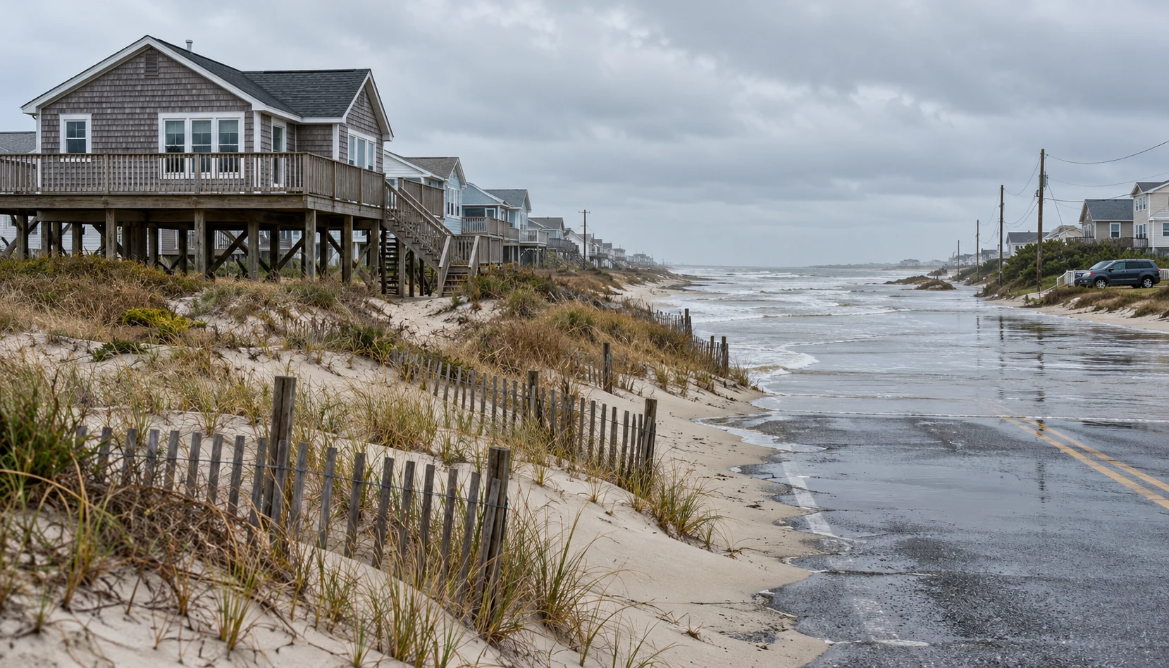
A long-duration nor’easter threatens repeated coastal flooding from the Outer Banks to Hampton Roads. Move your car to higher ground before water reaches your route, check local evacuation instructions, and prepare for disrupted road access. NWS warnings issued October 18 cover Hatteras and Ocracoke through Tuesday; farther north, alert windows extend into Wednesday. The next high tide may be only one of several difficult travel windows.
This report uses official bulletins saved October 18 at 7:26 a.m. MDT (9:26 a.m. EDT). Alert windows below are forecasts from those snapshots, not a live road-status service. Read the latest local alert before acting.
Where the coastal flood alerts are
The Newport/Morehead City warning and Wakefield watch/advisory bulletin give different windows for different communities. All times in this table are EDT; “as of” is the office’s issuance time on October 18. Inundation means water above normally dry ground in the specified low-lying shoreline and tidal-waterway areas, not water across every street.
| Area | Alert | Window (EDT) | Expected or possible inundation | NWS office | As of, Oct. 18 (EDT) |
|---|---|---|---|---|---|
| Hatteras Island | Coastal Flood Warning | Through Tue., Oct. 20, 5 p.m. | 2–4 ft expected | Newport/Morehead City | 3:24 a.m. |
| Ocracoke Island | Coastal Flood Warning | Through Tue., Oct. 20, 5 p.m. | 2–4 ft expected | Newport/Morehead City | 3:24 a.m. |
| Chesapeake, Suffolk, Norfolk and Portsmouth | Coastal Flood Advisory; then Watch | Advisory Sun., Oct. 18, 1–7 p.m.; Watch Mon. afternoon–Wed. morning, Oct. 19–21 | Up to 1 ft expected Sunday; 1–2 ft possible in watch window | Wakefield | 5:36 a.m. |
| Virginia Beach | Coastal Flood Advisory; then Watch | Advisory Sun., Oct. 18, 1–7 p.m.; Watch Mon. afternoon–Wed. morning, Oct. 19–21 | Up to 1 ft expected Sunday; 1–2 ft possible in watch window | Wakefield | 5:36 a.m. |
| Surry and James City counties | Coastal Flood Watch | Mon. afternoon–Wed. morning, Oct. 19–21 | 1–2 ft possible | Wakefield | 5:36 a.m. |
This is a selected-area table, not a complete list of alerts. The warning also forecasts 9–14 ft breaking waves in Hatteras’s surf zone. That wave height is a separate hazard from the ground-level inundation forecast; neither number tells you a road is passable.
Why this needs a multi-day plan
The Wakefield briefing issued at 9 a.m. EDT October 18 describes coastal flooding through at least midweek, with uncertainty tied to the storm’s track. The Newport/Morehead City briefing from 4:15 p.m. EDT October 17 also highlights the possibility of being stranded on Hatteras or Ocracoke for multiple days.
The practical difference is repetition: water receding after one high tide does not establish that the next trip will be safe. The Hatteras warning says vulnerable sections of NC-12 may flood, especially around high tide, and describes overwash across multiple tide cycles. Plan around the latest road closures and official instructions, rather than choosing a single “peak storm” hour for every task.
Wakefield’s October 18 briefing also notes wind advisories for Virginia Beach and the Northern Outer Banks. The local wind bulletins saved with this report warn that limbs could fall and a few outages may result. That supports preparing lights and charging devices; it does not mean every household will lose electricity.
Hatteras evacuation: visitors, not residents
Dare County’s October 16 bulletin declared a state of emergency for Hatteras Island effective 6 p.m. that day, with a mandatory visitor evacuation effective 8 p.m. The order covers Rodanthe, Waves, Salvo, Avon, Buxton, Frisco and Hatteras Village. The bulletin explicitly says it does not order Hatteras residents or areas north of Oregon Inlet to evacuate.
The county anticipated extended NC-12 closures from repeated overwash. WRAL’s local coverage also reports suspended Ocracoke ferry service. Treat that as a dated report, not a promise about the next sailing. Check the county’s current instructions and transportation updates before attempting to leave or return; never assume a ferry is an available backup route.
What to do at home before water arrives
Start with the route your household actually uses. Move a vehicle to permitted higher ground while the route is dry and open. Bring essential documents and medicines where you can reach them, and lift portable belongings from low floors if doing so is safe. Do not enter water or delay an evacuation to protect possessions.
Ready.gov’s flood guidance recommends supplies including water and nonperishable food for several days if services are cut off. For this event, use three days or more as a household planning starting point, not a prediction that access will return on that schedule. Account for prescriptions, pets and anyone who depends on powered medical equipment; arrange needed assistance before access becomes difficult.
Charge your phone and power bank while electricity is available. Put lights and the radio within reach rather than in a car or storage space that could become inaccessible. Share the plan with everyone at home, including how to receive alerts if the phone battery runs low. Our home outage checklist and emergency radio guide can help organize what you already own.
If power fails, keep exhaust outside
Use Ready.gov’s outage guidance to review household needs before the lights go out. If you rely on powered medical equipment, confirm a workable backup or relocation plan with the appropriate provider; a charged phone alone is not a power plan for that equipment.
CPSC’s generator guidance says portable generators belong outside, at least 20 feet from the house. Never run one in a home, garage, basement, crawlspace or shed, or on a porch or in a carport. Do not improvise an enclosed location to keep a generator out of the weather.
CPSC also calls for battery-operated or battery-backup CO alarms on each level and outside sleeping areas. Check your smoke and carbon monoxide alarm plan before an outage makes the task harder.
Flooded roads: turn around
The NWS message is direct: Turn Around Don’t Drown. Do not drive or walk into floodwater, even if a familiar road appears shallow. Water can hide a damaged road surface. A larger vehicle is not a reason to cross.
Treat coastal saltwater overwash as floodwater, too. Do not drive through it to reach a supposedly better parking spot or test whether the route is open. Move the vehicle before flooding begins; if the road is already flooded, turn around and follow closures.
For updates, check the current NWS warning, Wakefield alerts, NOAA’s local water information, DriveNC road conditions and Dare County’s current emergency notices. The county bulletin points readers to DareNC alerts and NCDOT Ferry Division updates; use those official channels for changing local instructions.
If the road closes for days
Build the plan around staying supplied without another shopping trip—and leaving when officials direct you to. Review drinking water storage, the 72-hour kit checklist and your household outage supplies. The kit name is an organizing tool, not a forecast for the length of this disruption.
Keep a car go-bag ready for a safe departure window. Check radios and backup communication and smoke/CO alarms. Use the official updates to decide when travel is safe; no checklist overrides an evacuation order or a closed road.
